
Wuqing District topographic map
Interactive map
Click on the map to display elevation.
About this map
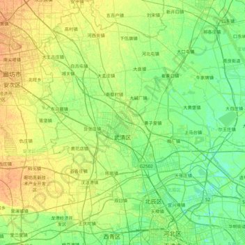
Name: Wuqing District topographic map, elevation, terrain.
Location: Wuqing District, Tianjin, 301727, PRC (39.13280 116.77899 39.70913 117.33388)
Average elevation: 8 m
Minimum elevation: -1 m
Maximum elevation: 21 m
Other topographic maps
Click on a map to view its topography, its elevation and its terrain.