
Menongue topographic map
Interactive map
Click on the map to display elevation.
About this map
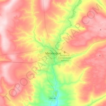
Name: Menongue topographic map, elevation, terrain.
Location: Menongue, Cuando Cubango Province, Angola (-14.82107 17.52203 -14.50107 17.84203)
Average elevation: 1,428 m
Minimum elevation: 1,285 m
Maximum elevation: 1,538 m