
Boisgeloup topographic map
Interactive map
Click on the map to display elevation.
About this map
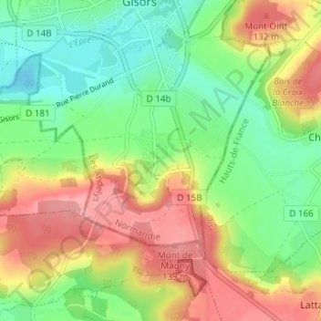
Name: Boisgeloup topographic map, elevation, terrain.
Average elevation: 88 m
Minimum elevation: 42 m
Maximum elevation: 146 m
Other topographic maps
Click on a map to view its topography, its elevation and its terrain.
Château de Gisors
France > Normandie > Eure > Gisors
Château de Gisors, Passage du Monarque, Gisors, Les Andelys, Eure, Normandie, France métropolitaine, 27140, France
Average elevation: 66 m