
Ndeke topographic map
Interactive map
Click on the map to display elevation.
About this map
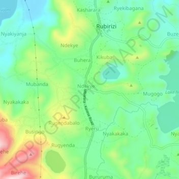
Name: Ndeke topographic map, elevation, terrain.
Location: Ndeke, Rubirizi, Western Region, Uganda (-0.31108 30.08508 -0.27108 30.12508)
Average elevation: 1,371 m
Minimum elevation: 1,256 m
Maximum elevation: 1,605 m
Other topographic maps
Click on a map to view its topography, its elevation and its terrain.