Geolocate

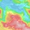
Colado topographic map

Click on the map to display elevation.

About this map

Name: Colado topographic map, elevation, terrain.

Location: Colado, Santa Mariña do Monte, San Sadurniño, Ferrol, A Coruña, Galicia, 15561, Spain (43.55773 -8.09182 43.59773 -8.05182)

Average elevation: 226 m

Minimum elevation: 133 m

Maximum elevation: 331 m

Other topographic maps

Click on a map to view its topography, its elevation and its terrain.
San Román de Montoxo

Spain > Galicia > Ferrol

Average elevation: 200 m

Ferrol

Spain > Galicia > Ferrol

Average elevation: 67 m

San Sadurniño

Spain > Galicia > Ferrol

Average elevation: 203 m

Valdoviño

Spain > Galicia > Ferrol

Average elevation: 84 m

Cedeira

Spain > Galicia > Ferrol

Average elevation: 91 m

Valdoviño

Spain > Galicia > Ferrol

Average elevation: 84 m

Anca

Spain > Galicia > Ferrol > Neda

Average elevation: 124 m

Doso

Spain > Galicia > Ferrol > Narón

Average elevation: 64 m

Moeche

Spain > Galicia > Ferrol

Average elevation: 206 m

Vilarrube

Spain > Galicia > Ferrol > Valdoviño

Average elevation: 125 m

Narón

Spain > Galicia > Ferrol

Average elevation: 85 m

Cedeira

Spain > Galicia > Ferrol

Average elevation: 91 m

Sedes

Spain > Galicia > Ferrol > Narón

Average elevation: 128 m

Cervás

Spain > Galicia > Ferrol > Ares

Average elevation: 44 m

Gear up for your next adventure:

🎒Hiking Child Carriers - Explore the outdoors with the whole family safely
📸Action Camera Chest Mounts - Record your ascent following topographic paths hands-free
📷Outdoor Action Cameras - Cameras designed for hiking and adventure
🔪Outdoor Multi-Tools - Versatile tools for gear repairs and food prep in the wild
📚UK Hiking Guidebooks - Detailed route descriptions for the Lake District, Peaks, and Highlands

As an Amazon Associate, this site earns from qualifying purchases at no extra cost to you.