
San Antonio topographic map
Interactive map
Click on the map to display elevation.
About this map
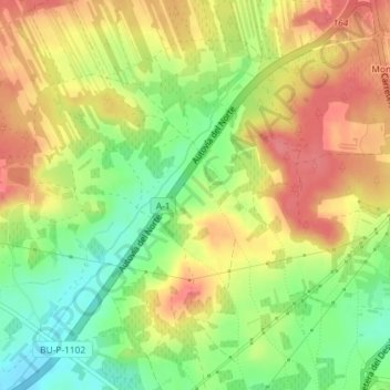
Name: San Antonio topographic map, elevation, terrain.
Average elevation: 839 m
Minimum elevation: 798 m
Maximum elevation: 875 m
Other topographic maps
Click on a map to view its topography, its elevation and its terrain.
Ribera del Duero
Spain > Castile and León > Aranda de Duero
Ribera del Duero, Aranda de Duero, Burgos, Castile and León, Spain
Average elevation: 800 m
Ribera del Duero
Spain > Castile and León > Aranda de Duero
Ribera del Duero, Aranda de Duero, Burgos, Castile and León, Spain
Average elevation: 801 m