
Towanda topographic map
Interactive map
Click on the map to display elevation.
About this map
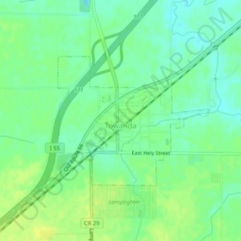
Name: Towanda topographic map, elevation, terrain.
Location: Towanda, McLean County, Illinois, 61776, United States (40.55720 -88.90967 40.57165 -88.88586)
Average elevation: 239 m
Minimum elevation: 230 m
Maximum elevation: 246 m
Other topographic maps
Click on a map to view its topography, its elevation and its terrain.
Bloomington
United States > Illinois > McLean County
Bloomington, McLean County, Illinois, United States
Average elevation: 246 m
Hudson
United States > Illinois > McLean County
Hudson, McLean County, Illinois, United States
Average elevation: 234 m
Normal
United States > Illinois > McLean County
Normal, McLean County, Illinois, United States
Average elevation: 249 m
Anchor
United States > Illinois > McLean County
Anchor, McLean County, Illinois, United States
Average elevation: 235 m