
Vijayapura topographic map
Interactive map
Click on the map to display elevation.
Vijayapura
Vijayapura is located at 13°17′N 77°48′E / 13.29°N 77.8°E / 13.29; 77.8. It has an average elevation of 883 metres (2896 feet).
About this map
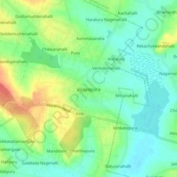
Name: Vijayapura topographic map, elevation, terrain.
Average elevation: 887 m
Minimum elevation: 871 m
Maximum elevation: 918 m