
Champoussin topographic map
Interactive map
Click on the map to display elevation.
About this map
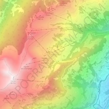
Name: Champoussin topographic map, elevation, terrain.
Location: Champoussin, Val-d'Illiez, Monthey, Wallis, 1873, Schweiz (46.18829 6.84285 46.22829 6.88285)
Average elevation: 1,572 m
Minimum elevation: 865 m
Maximum elevation: 2,149 m
Other topographic maps
Click on a map to view its topography, its elevation and its terrain.