Geolocate

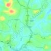
Anandappally topographic map

Click on the map to display elevation.

About this map

Name: Anandappally topographic map, elevation, terrain.

Location: Anandappally, Adoor, Pathanamthitta, Kerala, 691554, India (9.15520 76.72120 9.19520 76.76120)

Average elevation: 42 m

Minimum elevation: 18 m

Maximum elevation: 101 m

Other topographic maps

Click on a map to view its topography, its elevation and its terrain.
Jawahar

India > Kerala > Adoor > Anandappally

Average elevation: 45 m

Gear up for your next adventure:

🗺️Ordnance Survey Maps - Official UK maps for walking and outdoor activities
👖Hiking Trousers - Durable trousers designed for rough terrain
🧥Waterproof Hiking Jackets - Rain protection for walking in all weather conditions
🛌Sleeping Bags - Warm and packable sleeping bags for outdoor nights
⛺Camping Shelters - Emergency and lightweight shelters for outdoor use

As an Amazon Associate, this site earns from qualifying purchases at no extra cost to you.