
Yagodnoye topographic map
Interactive map
Click on the map to display elevation.
About this map
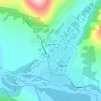
Name: Yagodnoye topographic map, elevation, terrain.
Average elevation: 522 m
Minimum elevation: 466 m
Maximum elevation: 794 m
Other topographic maps
Click on a map to view its topography, its elevation and its terrain.
Debin
Russia > Magadan Oblast > Yagodninsky Urban District
Debin, Yagodninsky Urban District, Magadan Oblast, Far Eastern Federal District, Russia
Average elevation: 338 m