
Arzl topographic map
Interactive map
Click on the map to display elevation.
About this map
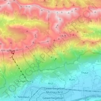
Name: Arzl topographic map, elevation, terrain.
Location: Arzl, Innsbruck, Tyrol, Austria (47.26791 11.37567 47.35634 11.44961)
Average elevation: 1,422 m
Minimum elevation: 557 m
Maximum elevation: 2,701 m
Other topographic maps
Click on a map to view its topography, its elevation and its terrain.