Geolocate

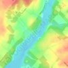
Dracon topographic map

Click on the map to display elevation.

About this map

Name: Dracon topographic map, elevation, terrain.

Location: Dracon, Centre Wellington, Wellington County, Southwestern Ontario, Ontario, N0B 1J0, Canada (43.80935 -80.39288 43.82935 -80.37288)

Average elevation: 463 m

Minimum elevation: 447 m

Maximum elevation: 478 m

Other topographic maps

Click on a map to view its topography, its elevation and its terrain.

Gear up for your next adventure:

☕Insulated Travel Mugs - Keep drinks hot while surveying the landscape from a summit
🛌Sleeping Mats - Insulated mats for comfortable outdoor sleeping
📦Compression Sacks - Reduce backpack volume efficiently
👟Men's Trail Running Shoes - Lightweight grip for fast movement over topographic contours
🥾Trekking Poles - Poles to improve stability on uneven terrain

As an Amazon Associate, this site earns from qualifying purchases at no extra cost to you.