

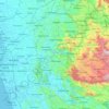
Rakwana topographic map
Click on the map to display elevation.
Rakwana
Located at an elevation of 464 m (1,522 ft), north of Sinharaja Mountains, on the A17 highway. It is 12 km (7.5 mi) from Rakwana-Deniyaya on the way to Galle. It also has roads leading to Embilipitiya and Kalawana. Rakwana acts as one of the gateways for the famous Sinharaja Forest reserve.
About this map
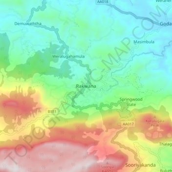
Name: Rakwana topographic map, elevation, terrain.
Average elevation: 609 m
Minimum elevation: 201 m
Maximum elevation: 1,355 m
Other topographic maps
Click on a map to view its topography, its elevation and its terrain.
Sinharaja Forest Reserve
Sri Lanka > Sabaragamuwa Province > Palinda-Nuwara (Baduraliya) DS Division
Average elevation: 374 m
Sinharaja Forest Reserve
Sri Lanka > Sabaragamuwa Province > Palinda-Nuwara (Baduraliya) DS Division
Average elevation: 374 m
Sinharaja Forest Reserve
Sri Lanka > Sabaragamuwa Province > Palinda-Nuwara (Baduraliya) DS Division
Average elevation: 374 m
