Geolocate

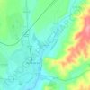
Nisa topographic map

Click on the map to display elevation.

About this map

Name: Nisa topographic map, elevation, terrain.

Location: Nisa, Portalegre, Portugal (39.37724 -7.88292 39.66368 -7.48047)

Average elevation: 269 m

Minimum elevation: 48 m

Maximum elevation: 759 m

Other topographic maps

Click on a map to view its topography, its elevation and its terrain.

Fernando

Portugal > Portalegre > Ponte de Sor

Average elevation: 228 m

Barroqueira

Portugal > Portalegre > Ponte de Sor

Average elevation: 134 m

Gear up for your next adventure:

🔪Outdoor Multi-Tools - Versatile tools for gear repairs and food prep in the wild
🥼Base Layers - Thermal base layers for temperature regulation
🌄Compact Monoculars - Lightweight optics for hiking
🎒Replacement Sternum Straps - Repair parts for hiking rucksacks
⛺Camping Shelters - Emergency and lightweight shelters for outdoor use

As an Amazon Associate, this site earns from qualifying purchases at no extra cost to you.