
Kasaï topographic map
Interactive map
Click on the map to display elevation.
About this map
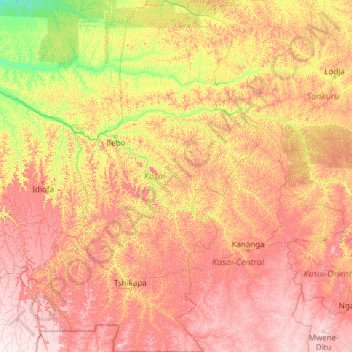
Name: Kasaï topographic map, elevation, terrain.
Location: Kasaï, RD Congo (-7.28333 19.67378 -2.46455 22.53856)
Average elevation: 559 m
Minimum elevation: 303 m
Maximum elevation: 1,036 m
Other topographic maps
Click on a map to view its topography, its elevation and its terrain.