
Végueta topographic map
Interactive map
Click on the map to display elevation.
About this map
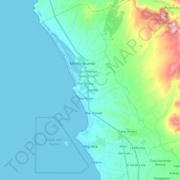
Name: Végueta topographic map, elevation, terrain.
Location: Végueta, Provincia de Huaura, Lima, Perú (-11.06110 -77.70160 -10.86003 -77.52263)
Average elevation: 114 m
Minimum elevation: 0 m
Maximum elevation: 679 m