
Veliki Preslav topographic map
Interactive map
Click on the map to display elevation.
Veliki Preslav
The modern Veliki Preslav or Great Preslav (Bulgarian: Велики Преслав, pronounced [vɛˈliki prɛˈsɫaf]), former Preslav (Bulgarian: Преслав; until 1993), is a city and the seat of government of the Veliki Preslav Municipality (Great Preslav Municipality, new Bulgarian: obshtina), which in turn is part of Shumen Province, Bulgaria. Veliki Preslav is situated at an altitude of 132 m (92 m above sea level).
About this map
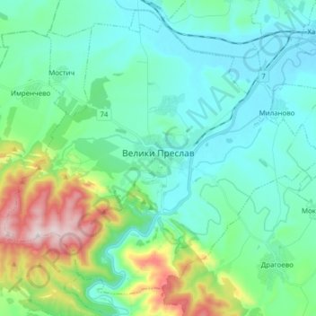
Name: Veliki Preslav topographic map, elevation, terrain.
Location: Veliki Preslav, Shumen, Bulgaria (43.11000 26.73636 43.20754 26.89182)
Average elevation: 225 m
Minimum elevation: 88 m
Maximum elevation: 720 m
Other topographic maps
Click on a map to view its topography, its elevation and its terrain.