Geolocate

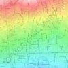
Punak topographic map

Click on the map to display elevation.

About this map

Name: Punak topographic map, elevation, terrain.

Location: Punak, ناحیه ۳, District 5, Tehran, Central Tehran section, Tehran County, Tehran Province, Iran (35.75093 51.31585 35.78199 51.34355)

Average elevation: 1,493 m

Minimum elevation: 1,379 m

Maximum elevation: 1,638 m

Other topographic maps

Click on a map to view its topography, its elevation and its terrain.

traffic

Iran > Tehran Province > Tehran County > Tehran

Average elevation: 1,329 m

Laleh Park

Iran > Tehran Province > Tehran County > Tehran

Average elevation: 1,245 m

میدان صنعت

Iran > Tehran Province > Tehran County > Tehran

Average elevation: 1,442 m

Arghavan

Iran > Tehran Province > Tehran County > Tehran

Average elevation: 1,398 m

Laleh Park

Iran > Tehran Province > Tehran County > Tehran

Average elevation: 1,245 m

Laleh Park

Iran > Tehran Province > Tehran County > Tehran

Average elevation: 1,245 m

Laleh Park

Iran > Tehran Province > Tehran County > Tehran

Average elevation: 1,245 m

Talash 2 Park

Iran > Tehran Province > Tehran County > Tehran

Average elevation: 1,133 m

Gear up for your next adventure:

🧭GPS Trackers - Tracking devices for safety and navigation
🔋Solar Power Banks - Keep your GPS and phone charged during multi-day expeditions
🧴Sport Sunscreen Sticks - High-protection sunblock that won't run into your eyes on the trail
🧴Tick Removal Tools - Small, essential health tool for UK woodland and moorland
🛰️Handheld GPS Devices - Reliable GPS units for hiking and outdoor navigation

As an Amazon Associate, this site earns from qualifying purchases at no extra cost to you.