Geolocate

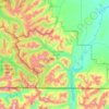
Buchanan Ridge topographic map

Click on the map to display elevation.

About this map

Name: Buchanan Ridge topographic map, elevation, terrain.

Location: Buchanan Ridge, Improvement District No. 04, Alberta, Canada (49.04025 -113.98586 49.04035 -113.98576)

Average elevation: 2,094 m

Minimum elevation: 1,646 m

Maximum elevation: 2,629 m

Other topographic maps

Click on a map to view its topography, its elevation and its terrain.
Waterton Lakes National Park

Canada > Alberta > Improvement District No. 04

Operated by Parks Canada, Waterton is open all year, but the main tourist season is during July and August. The only commercial facilities available within the park are located at the Waterton Park townsite. This park ranges in elevation from 1,290 metres (4,232 ft) at the townsite to 2,910 m (9,547 ft) at…

Average elevation: 1,778 m

Bertha Lake

Canada > Alberta > Improvement District No. 04

Average elevation: 1,968 m

Gear up for your next adventure:

🎿Telescopic Trekking Poles - Reduces knee strain on steep topographic descents
🔦Waterproof LED Headlamps - Hands-free lighting for evening treks and emergency navigation
🗺️Ordnance Survey Maps - Essential paper maps for hiking across the UK national parks
🧭Professional Hiking Compasses - High-precision liquid-filled compasses for map reading and orientation
📚UK Hiking Guidebooks - Detailed route descriptions for the Lake District, Peaks, and Highlands

As an Amazon Associate, this site earns from qualifying purchases at no extra cost to you.