
Thank you for supporting this site ❤️
Make a donation
Make a donation
Gear up for your next adventure:
As an Amazon Associate, this site earns from qualifying purchases at no extra cost to you.
Dédougou topographic map
Click on the map to display elevation.
Thank you for supporting this site ❤️
Make a donation
Make a donation
Gear up for your next adventure:
As an Amazon Associate, this site earns from qualifying purchases at no extra cost to you.
About this map
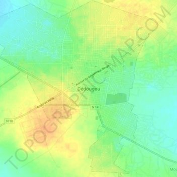
Name: Dédougou topographic map, elevation, terrain.
Location: Dédougou, Mouhoun, Boucle du Mouhoun, Burkina Faso (12.43865 -3.49039 12.48712 -3.44337)
Average elevation: 298 m
Minimum elevation: 284 m
Maximum elevation: 313 m
Thank you for supporting this site ❤️
Make a donation
Make a donation
Gear up for your next adventure:
As an Amazon Associate, this site earns from qualifying purchases at no extra cost to you.