
Hameau du Plessis topographic map
Interactive map
Click on the map to display elevation.
About this map
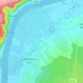
Name: Hameau du Plessis topographic map, elevation, terrain.
Average elevation: 21 m
Minimum elevation: -6 m
Maximum elevation: 146 m
Other topographic maps
Click on a map to view its topography, its elevation and its terrain.
Le Quesney
France > Normandie > Seine-Maritime > Vatteville-la-Rue
Le Quesney, Vatteville-la-Rue, Rouen, Seine-Maritime, Normandie, France métropolitaine, 76940, France
Average elevation: 20 m