
Froschberg topographic map
Interactive map
Click on the map to display elevation.
About this map
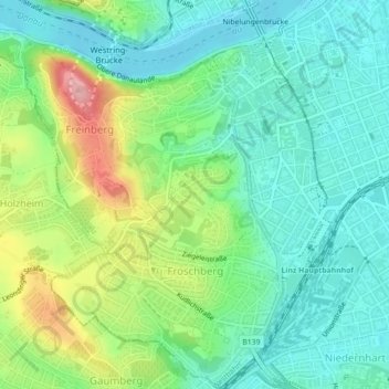
Name: Froschberg topographic map, elevation, terrain.
Location: Froschberg, Linz, Oberösterreich, 4022, Österreich (48.28047 14.24572 48.30982 14.28978)
Average elevation: 296 m
Minimum elevation: 250 m
Maximum elevation: 399 m
Other topographic maps
Click on a map to view its topography, its elevation and its terrain.
Innere Stadt
Österreich > Oberösterreich > Linz
Innere Stadt, Linz, Oberösterreich, Österreich
Average elevation: 272 m