
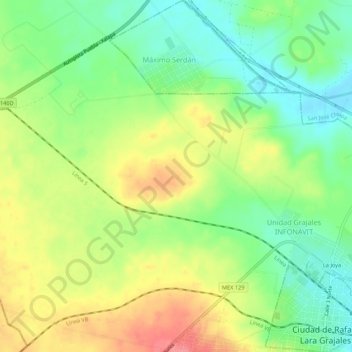
Rafael Lara Grajales topographic map
Interactive map
Click on the map to display elevation.
About this map
Name: Rafael Lara Grajales topographic map, elevation, terrain.
Location: Rafael Lara Grajales, Puebla, 75000, México (19.22199 -97.83836 19.27299 -97.79028)
Average elevation: 2,406 m
Minimum elevation: 2,371 m
Maximum elevation: 2,451 m