
Whitman Mission National Historic Site topographic map
Interactive map
Click on the map to display elevation.
About this map
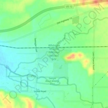
Name: Whitman Mission National Historic Site topographic map, elevation, terrain.
Average elevation: 196 m
Minimum elevation: 179 m
Maximum elevation: 224 m
Other topographic maps
Click on a map to view its topography, its elevation and its terrain.
Touchet
United States > Washington > Walla Walla County > Touchet
Touchet, Walla Walla County, Washington, 99360, United States
Average elevation: 139 m
Port Kelley
United States > Washington > Walla Walla County
Port Kelley, Walla Walla County, Washington, United States
Average elevation: 255 m
Walla Walla
United States > Washington > Walla Walla County > Walla Walla
Walla Walla, Walla Walla County, Washington, United States
Average elevation: 297 m
Wallula
United States > Washington > Walla Walla County
Wallula, Walla Walla County, Washington, United States
Average elevation: 119 m