La Celle-les-Bordes topographic map
Interactive map
Click on the map to display elevation.
About this map
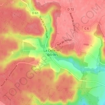
Name: La Celle-les-Bordes topographic map, elevation, terrain.
Average elevation: 156 m
Minimum elevation: 104 m
Maximum elevation: 178 m

Click on the map to display elevation.
Name: La Celle-les-Bordes topographic map, elevation, terrain.
Average elevation: 156 m
Minimum elevation: 104 m
Maximum elevation: 178 m