
Haugesund topographic map
Interactive map
Click on the map to display elevation.
About this map
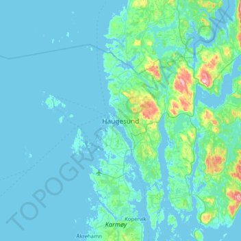
Name: Haugesund topographic map, elevation, terrain.
Location: Haugesund, Rogaland, 5525, Norway (59.37548 5.22365 59.45548 5.30365)
Average elevation: 35 m
Minimum elevation: -1 m
Maximum elevation: 224 m