
Gros Islet topographic map
Interactive map
Click on the map to display elevation.
About this map
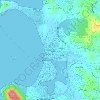
Name: Gros Islet topographic map, elevation, terrain.
Location: Gros Islet, Saint Lucia (14.07897 -60.95421 14.08341 -60.94717)
Average elevation: 19 m
Minimum elevation: -2 m
Maximum elevation: 172 m
Other topographic maps
Click on a map to view its topography, its elevation and its terrain.
Beausejour
Beausejour, Gros Islet, LC01 601, Saint Lucia
Average elevation: 32 m
Cas en bas
Saint Lucia > Gros Islet > Beausejour > Windward Hills
Cas en bas, Windward Hills, Beausejour, Gros Islet, Saint Lucia
Average elevation: 29 m
Gros Islet
Saint Lucia > Gros Islet > Gros Islet
Gros Islet, LCO1 101, Saint Lucia
Average elevation: 27 m