Geolocate

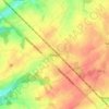
Grand-Manil topographic map

Click on the map to display elevation.

Grand-Manil

L'altitude de Grand-Manil se situe entre 125m et 167,5m.

Wikipedia (CC-BY-SA 3.0)

About this map

Name: Grand-Manil topographic map, elevation, terrain.

Location: Grand-Manil, Gembloux, Namur, Wallonie, Belgique (50.54404 4.62748 50.56873 4.68969)

Average elevation: 157 m

Minimum elevation: 122 m

Maximum elevation: 179 m

Other topographic maps

Click on a map to view its topography, its elevation and its terrain.
Ferooz

Belgique > Namur > Namur > Gembloux > Beuzet

Average elevation: 161 m

L'Orneau

Belgique > Namur > Namur > Gembloux

Average elevation: 158 m

Baudecet

Belgique > Namur > Namur > Gembloux > Sauvenière

Average elevation: 159 m

Beuzet

Belgique > Namur > Namur > Gembloux

Average elevation: 175 m

Grand-Leez

Belgique > Namur > Namur > Gembloux

Average elevation: 163 m

Corroy-le-Château

Belgique > Namur > Namur > Gembloux

Average elevation: 159 m

Gear up for your next adventure:

🧗Locking Carabiners - Secure gear to your pack or for light technical use
🥫Expedition Meals - Lightweight, high-calorie nutrition for long-distance hikers
🍳Camping Stoves - Compact stoves for outdoor cooking
🧤Thermal Touchscreen Gloves - Stay warm while operating your GPS or smartphone camera
🚶Walking Pedometers - Simple distance tracking for casual trail walkers

As an Amazon Associate, this site earns from qualifying purchases at no extra cost to you.