
Thank you for supporting this site ❤️
Make a donation
Make a donation
Gear up for your next adventure:
As an Amazon Associate, this site earns from qualifying purchases at no extra cost to you.
Pisuquía topographic map
Click on the map to display elevation.
Thank you for supporting this site ❤️
Make a donation
Make a donation
Gear up for your next adventure:
As an Amazon Associate, this site earns from qualifying purchases at no extra cost to you.
About this map
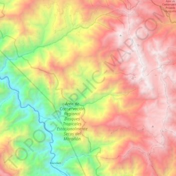
Name: Pisuquía topographic map, elevation, terrain.
Location: Pisuquía, Provincia de Luya, Amazonas, Perú (-6.56547 -78.20625 -6.37498 -77.99096)
Average elevation: 2,358 m
Minimum elevation: 681 m
Maximum elevation: 3,890 m
Thank you for supporting this site ❤️
Make a donation
Make a donation
Gear up for your next adventure:
As an Amazon Associate, this site earns from qualifying purchases at no extra cost to you.