Geolocate

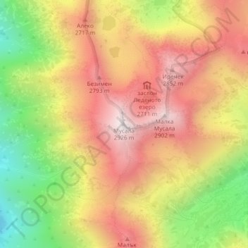
Musala topographic map

Click on the map to display elevation.

Musala

With a topographic prominence of 2,473 metres (8,114 ft), Musala is also the 6th highest peak by topographic prominence in mainland Europe. It is also the 3rd most topographically isolated major peak in Continental Europe.

Wikipedia (CC-BY-SA 3.0)

About this map

Name: Musala topographic map, elevation, terrain.

Location: Musala, Samokov, Sofia, Bulgaria (42.17914 23.58523 42.17924 23.58533)

Average elevation: 2,520 m

Minimum elevation: 2,017 m

Maximum elevation: 2,921 m

Gear up for your next adventure:

🍲Portable Camping Stoves - Fast-boiling stoves for hot meals on remote topographic survey trips
🧣Neck Gaiters - Versatile protection against wind and cold
🧥Waterproof Hiking Jackets - Rain protection for walking in all weather conditions
📸Action Camera Chest Mounts - Record your ascent following topographic paths hands-free
👕Merino Base Layers - Natural temperature regulation for cold weather hiking and camping

As an Amazon Associate, this site earns from qualifying purchases at no extra cost to you.