Geolocate

Anilao topographic map

Click on the map to display elevation.

About this map

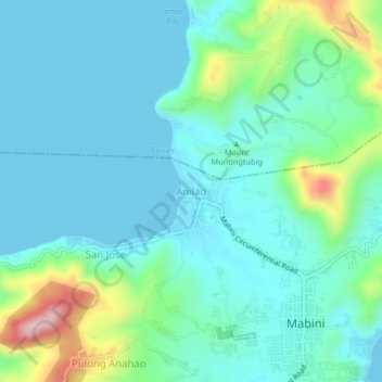
Name: Anilao topographic map, elevation, terrain.

Location: Anilao, Mabini, Batangas, Calabarzon, 4202, Philippines (13.74168 120.90840 13.78168 120.94840)

Average elevation: 59 m

Minimum elevation: 0 m

Maximum elevation: 296 m

Gear up for your next adventure:

🥼Base Layers - Thermal base layers for temperature regulation
🧣Fleece Neck Warmers - Extra insulation for winter topographic surveys
🎒Multi-day Trekking Packs - Large capacity backpacks for wild camping and long-distance trails
🌦️Portable Weather Meters - Handheld tools for monitoring weather conditions
🧥Waterproof Hiking Jackets - Rain protection for walking in all weather conditions

As an Amazon Associate, this site earns from qualifying purchases at no extra cost to you.