
Thank you for supporting this site ❤️
Make a donation
Make a donation
Gear up for your next adventure:
As an Amazon Associate, this site earns from qualifying purchases at no extra cost to you.
Benfeita topographic map
Click on the map to display elevation.
Thank you for supporting this site ❤️
Make a donation
Make a donation
Gear up for your next adventure:
As an Amazon Associate, this site earns from qualifying purchases at no extra cost to you.
About this map
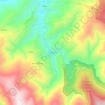
Name: Benfeita topographic map, elevation, terrain.
Location: Benfeita, Arganil, Coimbra, 3305-031, Portugal (40.21014 -7.96445 40.25014 -7.92445)
Average elevation: 519 m
Minimum elevation: 206 m
Maximum elevation: 872 m
Thank you for supporting this site ❤️
Make a donation
Make a donation
Gear up for your next adventure:
As an Amazon Associate, this site earns from qualifying purchases at no extra cost to you.