
Bir Bouhouche topographic map
Interactive map
Click on the map to display elevation.
About this map
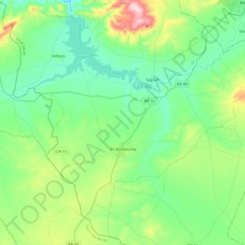
Name: Bir Bouhouche topographic map, elevation, terrain.
Location: Bir Bouhouche, Bir Bouhouche District, Souk Ahras, Algeria (35.95084 7.32756 36.11618 7.54725)
Average elevation: 823 m
Minimum elevation: 699 m
Maximum elevation: 1,156 m
Other topographic maps
Click on a map to view its topography, its elevation and its terrain.
Safel El Ouiden
Algeria > Souk Ahras > Bir Bouhouche District
Safel El Ouiden, Bir Bouhouche District, Souk Ahras, Algeria
Average elevation: 853 m