
手島 topographic map
Interactive map
Click on the map to display elevation.
About this map
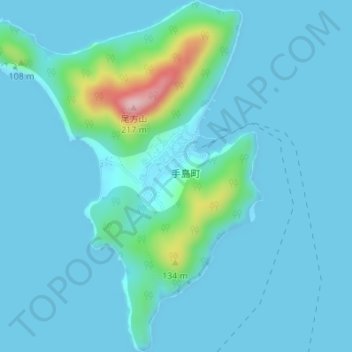
Name: 手島 topographic map, elevation, terrain.
Location: 手島, Marugame, Préfecture de Kagawa, Shikoku, Japon (34.38263 133.65084 34.41080 133.67800)
Average elevation: 22 m
Minimum elevation: -1 m
Maximum elevation: 205 m