Geolocate

Chêne Saint-Pierre | Arbre à clous topographic map

Interactive map

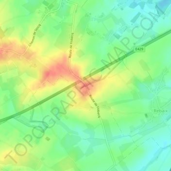
Click on the map to display elevation.

About this map

Name: Chêne Saint-Pierre | Arbre à clous topographic map, elevation, terrain.

Location: Chêne Saint-Pierre | Arbre à clous, Route de Flobecq, Bouvignies, Ath, Hainaut, Wallonie, 7803, Belgique (50.66407 3.76498 50.66417 3.76508)

Average elevation: 46 m

Minimum elevation: 24 m

Maximum elevation: 75 m

Other topographic maps

Click on a map to view its topography, its elevation and its terrain.

Irchonwelz

Belgique > Hainaut > Ath > Ath

Irchonwelz, Ath, Hainaut, Wallonie, 7801, Belgique

Average elevation: 46 m

Ath

Belgique > Hainaut > Ath > Ath

Ath, Hainaut, Wallonie, 7800, Belgique

Average elevation: 44 m