
Kegeshook Lake topographic map
Interactive map
Click on the map to display elevation.
About this map
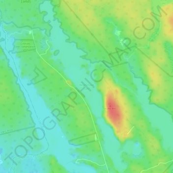
Name: Kegeshook Lake topographic map, elevation, terrain.
Average elevation: 37 m
Minimum elevation: 18 m
Maximum elevation: 72 m
Other topographic maps
Click on a map to view its topography, its elevation and its terrain.
East Quinan
Kanada > Neuschottland > East Quinan > East Quinan
East Quinan, Argyle Municipal District, Yarmouth County, Neuschottland, Kanada
Average elevation: 46 m