
Kalety topographic map
Interactive map
Click on the map to display elevation.
About this map
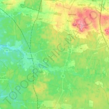
Name: Kalety topographic map, elevation, terrain.
Location: Kalety, Tarnowskie Góry County, 42-660, Poland (50.52027 18.81576 50.61727 19.04366)
Average elevation: 293 m
Minimum elevation: 253 m
Maximum elevation: 364 m