
Jasen topographic map
Interactive map
Click on the map to display elevation.
About this map
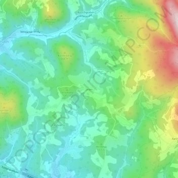
Name: Jasen topographic map, elevation, terrain.
Average elevation: 559 m
Minimum elevation: 400 m
Maximum elevation: 947 m
Other topographic maps
Click on a map to view its topography, its elevation and its terrain.
Kirchenviertel
Österreich > Steiermark > Bezirk Graz-Umgebung > Gratkorn > Kirchenviertel
Kirchenviertel, Gratkorn, Bezirk Graz-Umgebung, Steiermark, 8101, Österreich
Average elevation: 421 m