
Bernried topographic map
Interactive map
Click on the map to display elevation.
About this map
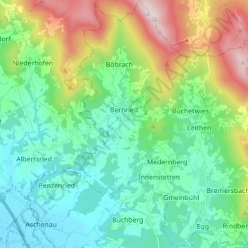
Name: Bernried topographic map, elevation, terrain.
Location: Bernried, Landkreis Deggendorf, Bayern, 94505, Deutschland (48.87332 12.85416 48.95456 12.95233)
Average elevation: 515 m
Minimum elevation: 316 m
Maximum elevation: 1,031 m