
Cervera topographic map
Interactive map
Click on the map to display elevation.
About this map
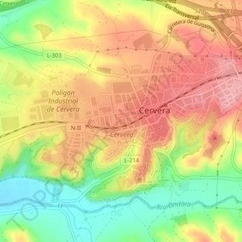
Name: Cervera topographic map, elevation, terrain.
Location: Cervera, Segarra, Lerida, Catalonië, 25200, Spanje (41.66387 1.25948 41.67981 1.28627)
Average elevation: 519 m
Minimum elevation: 453 m
Maximum elevation: 572 m