
Devin topographic map
Interactive map
Click on the map to display elevation.
Devin
The Devinska river runs through it and numerous other brooks and rivers (namely Krichim, Muglenska and Trigradska) are found nearby, all tributaries of the Vacha river. The altitude is uneven owing to the mountainous location, ranging from 684 m to around 800 m above sea level.
About this map
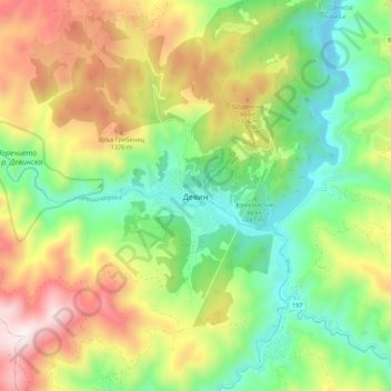
Name: Devin topographic map, elevation, terrain.
Location: Devin, Smolyan, 4800, Bulgaria (41.70336 24.35846 41.78336 24.43846)
Average elevation: 1,051 m
Minimum elevation: 637 m
Maximum elevation: 1,676 m