
Knottsville topographic map
Interactive map
Click on the map to display elevation.
About this map
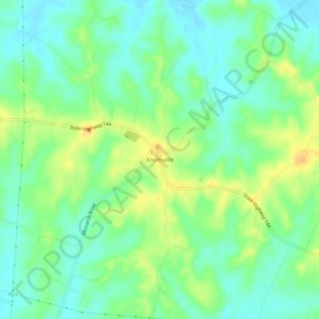
Name: Knottsville topographic map, elevation, terrain.
Location: Knottsville, Daviess County, Kentucky, United States (37.75172 -86.92416 37.79172 -86.88416)
Average elevation: 149 m
Minimum elevation: 129 m
Maximum elevation: 187 m
Other topographic maps
Click on a map to view its topography, its elevation and its terrain.
Owensboro
United States > Kentucky > Daviess County
Owensboro, Daviess County, Kentucky, United States
Average elevation: 123 m