
Dyo topographic map
Interactive map
Click on the map to display elevation.
About this map
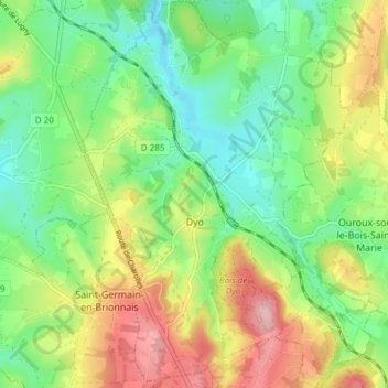
Name: Dyo topographic map, elevation, terrain.
Average elevation: 363 m
Minimum elevation: 289 m
Maximum elevation: 482 m
Other topographic maps
Click on a map to view its topography, its elevation and its terrain.
La Salle
Frankreich > Burgund und Freigrafschaft > Saône-et-Loire
La Salle, Mâcon, Saône-et-Loire, Burgund und Freigrafschaft, Metropolitanes Frankreich, 71260, Frankreich
Average elevation: 193 m
Marcigny
Frankreich > Burgund und Freigrafschaft > Saône-et-Loire
Marcigny, Charolles, Saône-et-Loire, Burgund und Freigrafschaft, Metropolitanes Frankreich, 71110, Frankreich
Average elevation: 275 m
La Queue du Renard
Frankreich > Burgund und Freigrafschaft > Saône-et-Loire > Dyo
La Queue du Renard, Dyo, Charolles, Saône-et-Loire, Burgund und Freigrafschaft, Metropolitanes Frankreich, 71800, Frankreich
Average elevation: 396 m