
Make a donation
Gear up for your next adventure:
As an Amazon Associate, this site earns from qualifying purchases at no extra cost to you.
Distrito 6 topographic map
Click on the map to display elevation.
Make a donation
Gear up for your next adventure:
As an Amazon Associate, this site earns from qualifying purchases at no extra cost to you.
About this map
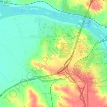
Name: Distrito 6 topographic map, elevation, terrain.
Location: Distrito 6, Mérida, Badajoz, Extremadura, España (38.90072 -6.39600 38.93149 -6.34177)
Average elevation: 223 m
Minimum elevation: 195 m
Maximum elevation: 261 m
Make a donation
Gear up for your next adventure:
As an Amazon Associate, this site earns from qualifying purchases at no extra cost to you.
Other topographic maps
Click on a map to view its topography, its elevation and its terrain.
Río Guadiana
España > Extremadura > Mérida
Una de sus múltiples fuentes, la que le otorga su nombre, se configura en la provincia española de Ciudad Real, en el manantial de los Ojos del Guadiana, situado en el término municipal de Villarrubia de los Ojos, a 608 m de altitud. Uno de los ríos que fluyen en su cabecera es el Guadiana Viejo,…
Average elevation: 222 m
Make a donation
Gear up for your next adventure:
As an Amazon Associate, this site earns from qualifying purchases at no extra cost to you.