Geolocate

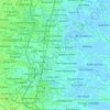
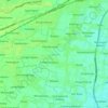
Sepande topographic map

Click on the map to display elevation.

About this map

Name: Sepande topographic map, elevation, terrain.

Location: Sepande, Candi, Sidoarjo, East Java, 61225, Indonesia (-7.48102 112.67642 -7.44102 112.71642)

Average elevation: 5 m

Minimum elevation: 1 m

Maximum elevation: 8 m

Other topographic maps

Click on a map to view its topography, its elevation and its terrain.
Jabon

Indonesia > East Java > Sidoarjo

Average elevation: 3 m

Candi

Indonesia > East Java > Sidoarjo

Average elevation: 3 m

Tulangan

Indonesia > East Java > Sidoarjo

Average elevation: 8 m

Sukodono

Indonesia > East Java > Sidoarjo

Average elevation: 8 m

Krembung

Indonesia > East Java > Sidoarjo

Average elevation: 10 m

Prambon

Indonesia > East Java > Sidoarjo

Average elevation: 13 m

Tanggulangin

Indonesia > East Java > Sidoarjo

Average elevation: 3 m

Gear up for your next adventure:

🍲Portable Camping Stoves - Fast-boiling stoves for hot meals on remote topographic survey trips
🧵Survival Paracord - Multi-purpose cordage for emergency repairs and shelters
👖Packable Overtrousers - Quick-deploy rain protection for legs in sudden storms
🔋Solar Power Banks - Keep your GPS and phone charged during multi-day expeditions
📸Action Camera Chest Mounts - Record your ascent following topographic paths hands-free

As an Amazon Associate, this site earns from qualifying purchases at no extra cost to you.