
Choir topographic map
Interactive map
Click on the map to display elevation.
Choir
Choir lies in the Choir Depression, a lowland strip about 150 km long and 10 to 20 km wide, about 500 m lower than the surrounding upland. It lies at an altitude of 1269 m.
About this map
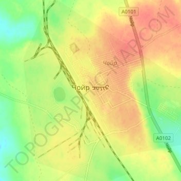
Name: Choir topographic map, elevation, terrain.
Location: Choir, Sumber, Govisumber, Mongolia (46.34189 108.34771 46.37456 108.39766)
Average elevation: 1,282 m
Minimum elevation: 1,256 m
Maximum elevation: 1,299 m