
Saint Clair Township topographic map
Interactive map
Click on the map to display elevation.
About this map
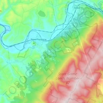
Name: Saint Clair Township topographic map, elevation, terrain.
Average elevation: 495 m
Minimum elevation: 309 m
Maximum elevation: 834 m
Other topographic maps
Click on a map to view its topography, its elevation and its terrain.
Park
Estados Unidos de América > Pensilvania > Westmoreland County > Irwin
Park, Irwin, Westmoreland County, Pensilvania, Estados Unidos de América
Average elevation: 314 m