
الحميمة topographic map
Interactive map
Click on the map to display elevation.
About this map
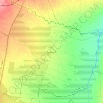
Name: الحميمة topographic map, elevation, terrain.
Location: الحميمة, معتمدية جلمة, Sidi Bouzid, Tunisia (35.16331 9.36973 35.25249 9.49255)
Average elevation: 328 m
Minimum elevation: 292 m
Maximum elevation: 377 m
Other topographic maps
Click on a map to view its topography, its elevation and its terrain.
Gazgazia
Tunisia > Sidi Bouzid > البسباس > Gazgazia
Gazgazia, البسباس, معتمدية المزونة, Sidi Bouzid, Tunisia
Average elevation: 61 m