Char Dara topographic map
Interactive map
Click on the map to display elevation.
About this map
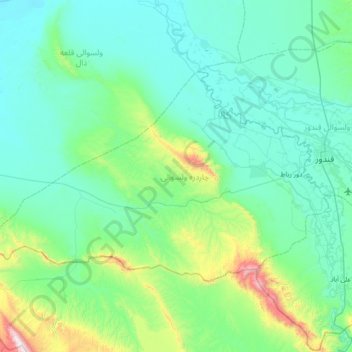
Name: Char Dara topographic map, elevation, terrain.
Location: Char Dara, Kunduz Province, Afghanistan (36.51789 68.16749 36.85823 68.87993)
Average elevation: 544 m
Minimum elevation: 325 m
Maximum elevation: 1,907 m
Other topographic maps
Click on a map to view its topography, its elevation and its terrain.
Mohajerin
Afghanistan > Kunduz Province > Khan Abad > Mohajerin
Mohajerin, Khan Abad, Kunduz Province, Afghanistan
Average elevation: 534 m
Kunduz
Afghanistan > Kunduz Province > Kunduz District > Kunduz
Kunduz, Kunduz District, Kunduz Province, Afghanistan
Average elevation: 453 m
Chahar Dara
Afghanistan > Kunduz Province > Char Dara
Chahar Dara, Char Dara, Kunduz Province, Afghanistan
Average elevation: 396 m